Nonsan (Nonsan-si)
Nonsan is a city in South Chungcheong Province, South Korea. It is located at 36.2°N, 127.08333°W. The origin of Nonsan's geographical names is said to have come from the small garden " Nolmoe, " which rises in the middle of farming fields, where rice paddies and mountain are said to reflect geographical features. The city belongs to the Daejeon Metropolitan Area.
Nonsan has a significant history. During the Samhan period, Nonsan is believed to have been part of Mahan territory. In the Baekje period, the district belonged to Hwangdeungyasan-gun. The crucial battle in which Silla defeated Baekje is thought to have taken place in the general area of Nonsan. Later, in the Silla period, Nonsan was divided into two different towns: Deogeun and Hwangsan.
The train station was built in 1911, in the same year as the rail line through the Nonsan plain was completed.
The modern city of Nonsan was established in 1914, by the merger of the four counties of Yeonsan-gun, Eunjin-gun, Noseong-gun and Seoksung-gun.
During the Korean War, a POW camp was set up by the U.S. and South Korean forces. On June 18, 1953, at the Nonsan camp as well as at POW camps at Busan, Masan, and Kwangju, thousands of POWs swarmed out of the camps and melted into the local population in order to avoid being repatriated to North Korea.
Map - Nonsan (Nonsan-si)
Map
Country - South_Korea
 |
 |
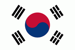
| Flag of South Korea | |
The Korean Peninsula was inhabited as early as the Lower Paleolithic period. Its first kingdom was noted in Chinese records in the early 7th century BCE. Following the unification of the Three Kingdoms of Korea into Silla and Balhae in the late 7th century, Korea was ruled by the Goryeo dynasty (918–1392) and the Joseon dynasty (1392–1897). The succeeding Korean Empire (1897–1910) was annexed in 1910 into the Empire of Japan. Japanese rule ended following Japan's surrender in World War II, after which Korea was divided into two zones; a northern zone occupied by the Soviet Union and a southern zone occupied by the United States. After negotiations on reunification failed, the southern zone became the Republic of Korea in August 1948 while the northern zone became the communist Democratic People's Republic of Korea the following month.
Currency / Language
| ISO | Currency | Symbol | Significant figures |
|---|---|---|---|
| KRW | South Korean won | â‚© | 0 |
| ISO | Language |
|---|---|
| EN | English language |
| KO | Korean language |


